Walking paradise La Gomera |
|---|


|
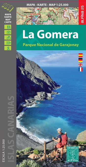
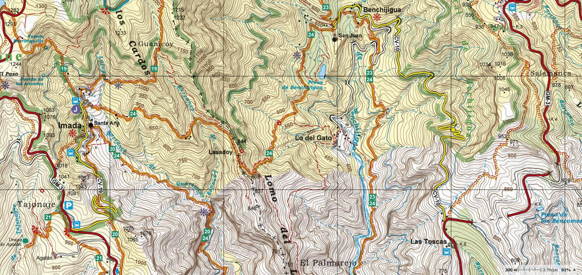
Hiking map, scale 1:25.000 (2018). Second edition available since 2023.
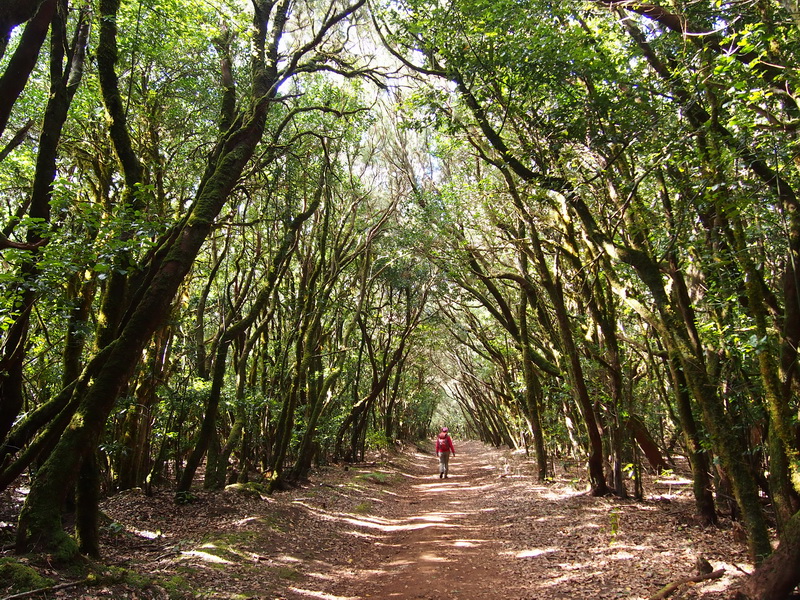
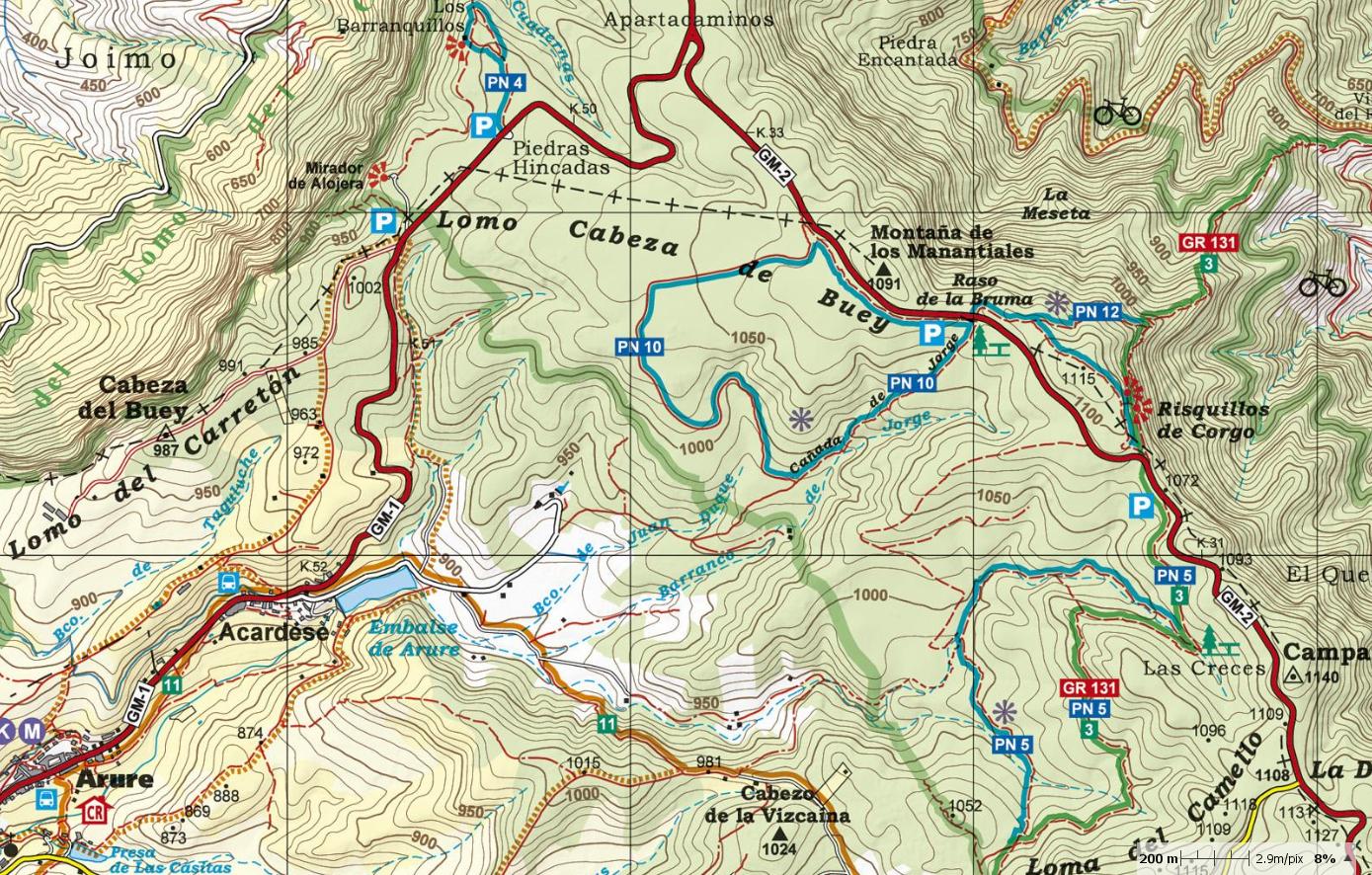
At the end of 2018, the publishing house Alpina (widely known in mainland Spain and in the Balearic Islands for its accurate and detailed hiking maps) published the first hiking map, at a scale of 1:25.000 of La Gomera (Canary Islands). The signposted paths: GR, 40 Routes of Cabildo de La Gomera and 18 National park routes have been marked as well as important heritage sites such as: Windmills, water sources, conduits and filtration galleries, threshing floors, water wells and dry docks. Also included are sites of touristic interest such as: Viewpoints, campsites, information centres and other attractions. On 2023, the second updated edition has been published. |
|


ALPINA HIKING MAPS LA PALMA/ LA GOMERA/ TENERIFE/GRAN CANARIA |
|---|
|
►Update your Alpina hiking map >> ►Around the paths- interesting information WORTH KNOWING >> ►Photo gallery: Mountain landscapes of the island >>
|
|---|
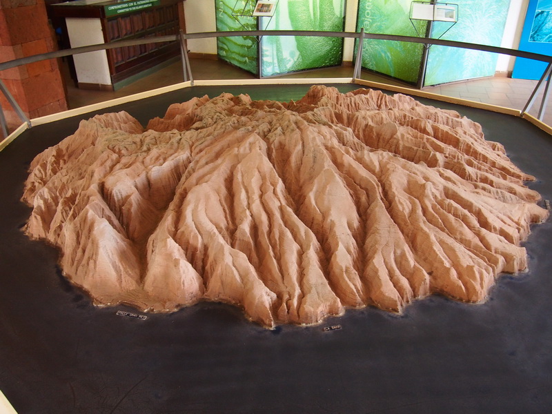
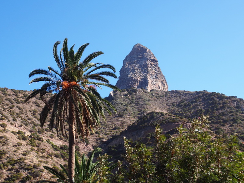
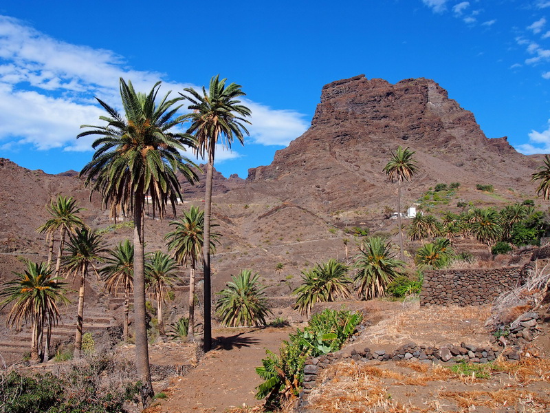
| The most important geological features: The deep canyons (Barrancos) and the volcanic domes (Roques) - Roque Cano |
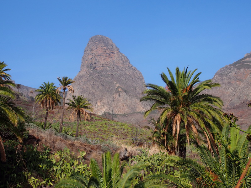
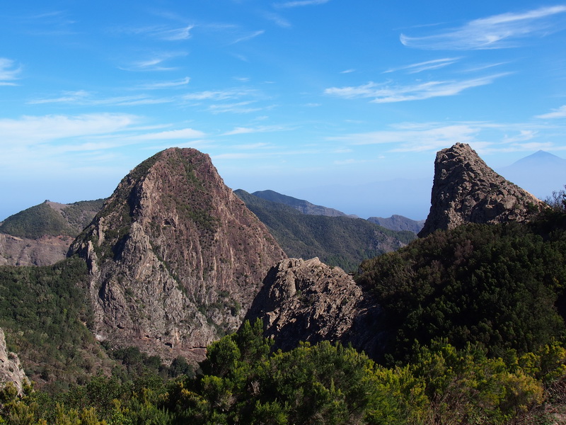
| Roque de Agando - Roque de Ojila - Roque de la Zarcita |
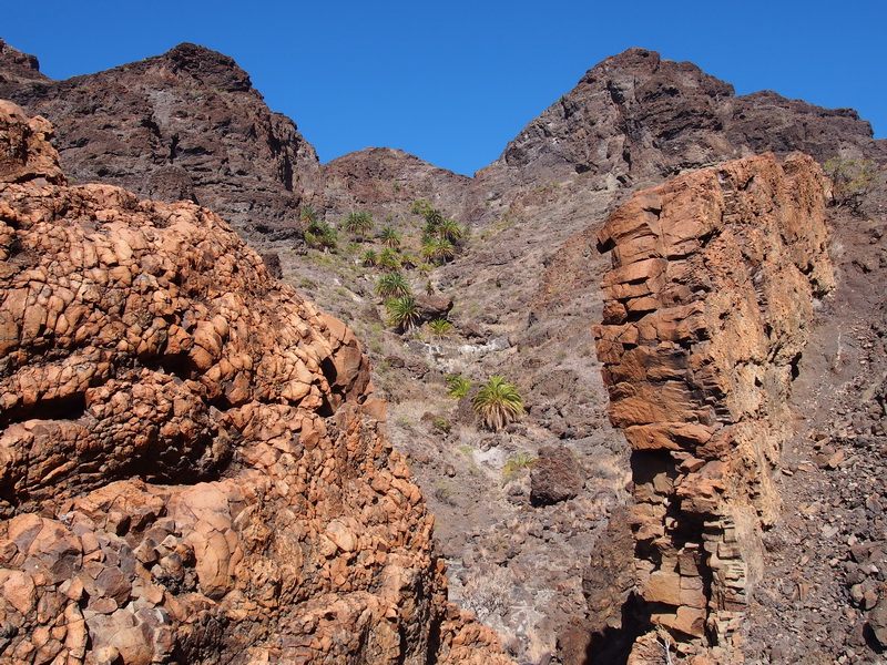
Taparucha- Volcanic dyke |