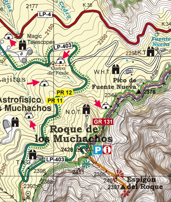
WORTH KNOWING |
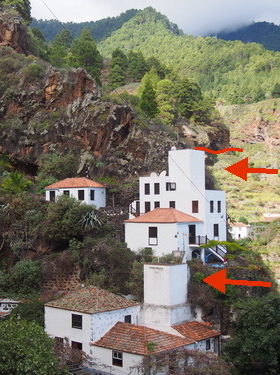
On the hiking map, we have located most of the heritage highlights that can be seen along the hiking paths. They tell us about the difficult life that the inhabitants endured until recent times
AGRICULTURAL TERRACES
These terraces can be seen all around the island, but most of them are found in the north. At the end of the 19th century, many landless farmers had to leave the island, while others decided to stay and work on the steep and stony slopes. They built terraces far away from their villages and farmed cereals and potatoes. It is worth walking along the narrow paths to see these abandoned terraces.
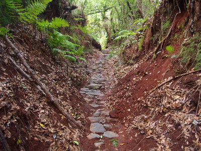
PATHS
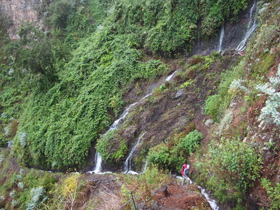
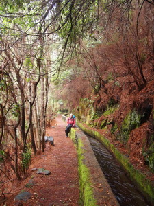
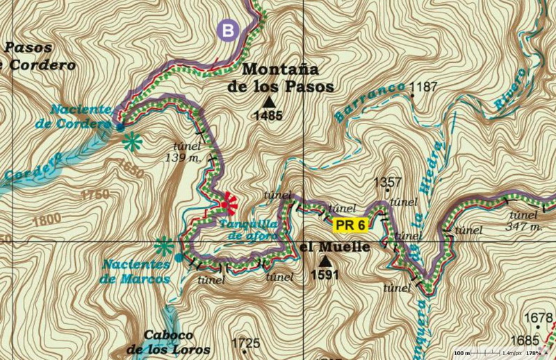
WATER CONDUITS, FILTRATION GALLERIES
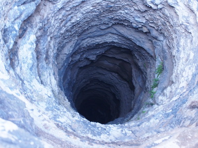
The springs in the mountains, the wells in the flatlands and the collection of rainwater in some houses (many couldn't even afford this) ensured that enough water was available for the locals. However, some areas in the west ran out of water in summer. The inhabitants descended to the coast and collected water from the salt-wells. Some spent the summer there with their herds.
The old water conduits were carved by hand across steep slopes and sheer cliffs, and were very narrow. In the 20th. century, larger water conduits were built, such as the one descending from the sources of Marcos y Cordero, wide enough to walk along them. This one also passes many tunnels, and some of them are over 100 metres long.
The filtration galleries are tunnels drilled and blasted through rocky mountains to tap into the water table. They allowed the expansion of banana cultivation in dry, sunny areas further south. On La Palma, there are 167 filtration galleries (average length: 1100 metres), 69 wells (average depth: 35 metres) and 300 water sources. Some difficult hikes follow narrow paths that were built across steep slopes to reach the galleries.
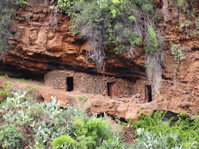
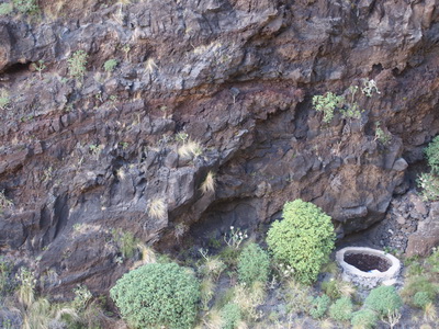
CAVES
Often, while crossing gorges, walled caves can be seen at the bottom of sheer cliffs walls. These were mostly used as livestock shelters, but some people are still living in the more luxurious ones.
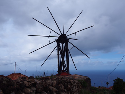
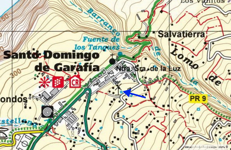
WINDMILLS
The wooden windmills grinded cereals for "gofio", the staple food of the Canary Islands. Between Santo Domingo de Garafía and Las Tricias, some of these have been restored.
WATERMILLS
Watermills ground cereals for "gofio", the staple food of the Canary Islands. They used the water from sources and gorges, and many were built along the same valley. Conduits connected the mills and water flowed from one to the next. The water from the gorge Barranco del Río was diverted, first to power the two mills of Molinos del Remanente, then another one, followed by the four mills Molinos de Bellido.
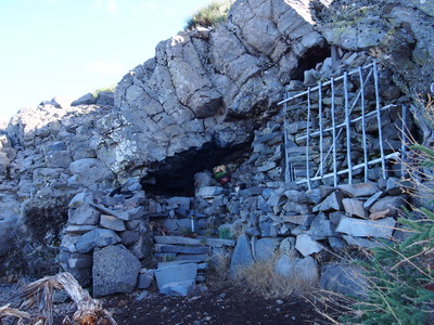
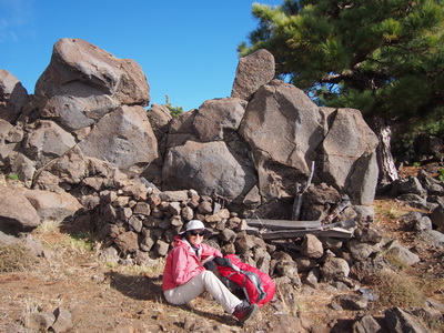
OLD SHEPHERD'S HUTS
These are found near the summit of Roque de los Muchachos and Pico de la Sabina, around the highest parts of the island, where the livestock grazed in the summer. A "luxurious" one lies near the source Fuente de la Tamagantera (PR 9).
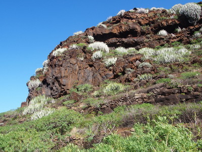
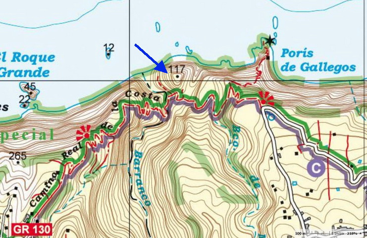
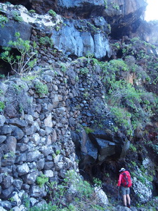
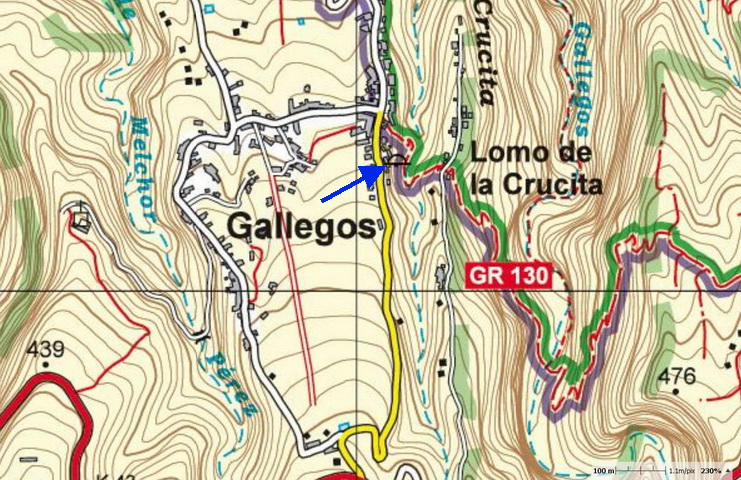
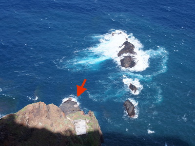
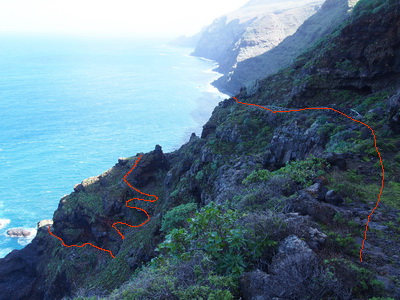
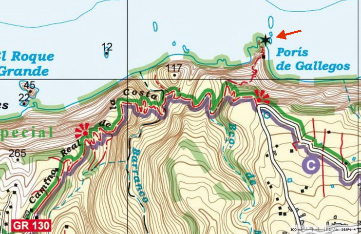
DRY DOCKS (Porís- Proís)
Until 1950, some villages hadn't been connected by road relying instead on sea transport was used often. The dry docks were built at the bottom of sheer cliffs, accessed by steep and difficult paths. The "porís" are smaller docks and the connecting paths are steeper, such as the one in Gallegos or Don Pedro.
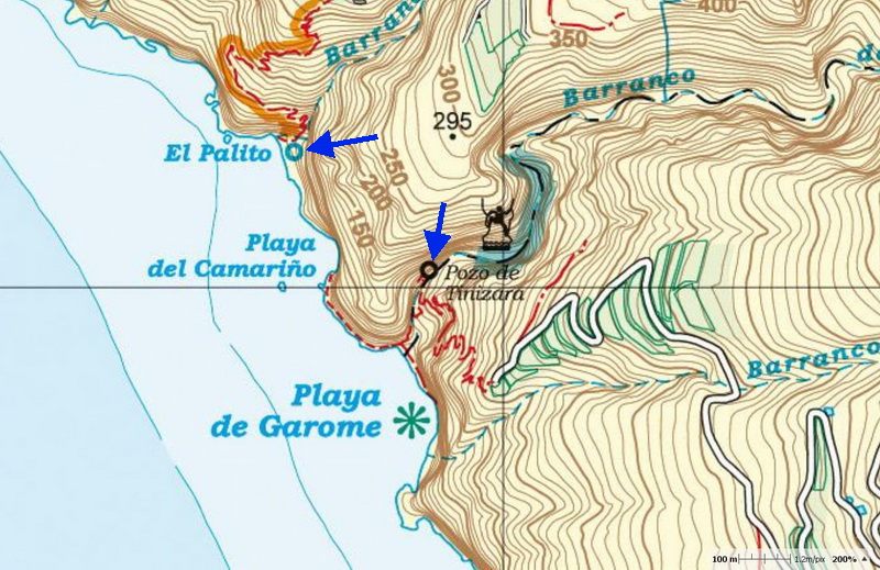
COASTAL SALT-WATER WELLS
The springs in the mountains, the wells in the flatlands and the collection of rainwater in some houses (many couldn't even afford this) ensured that enough water was available for the locals. However, some areas in the west ran out of water in summer. The inhabitants descended to the coast and collected water from the salt-wells. Some spent the summer there with their herds.