Walking paradise La Palma |
|---|


|
 |
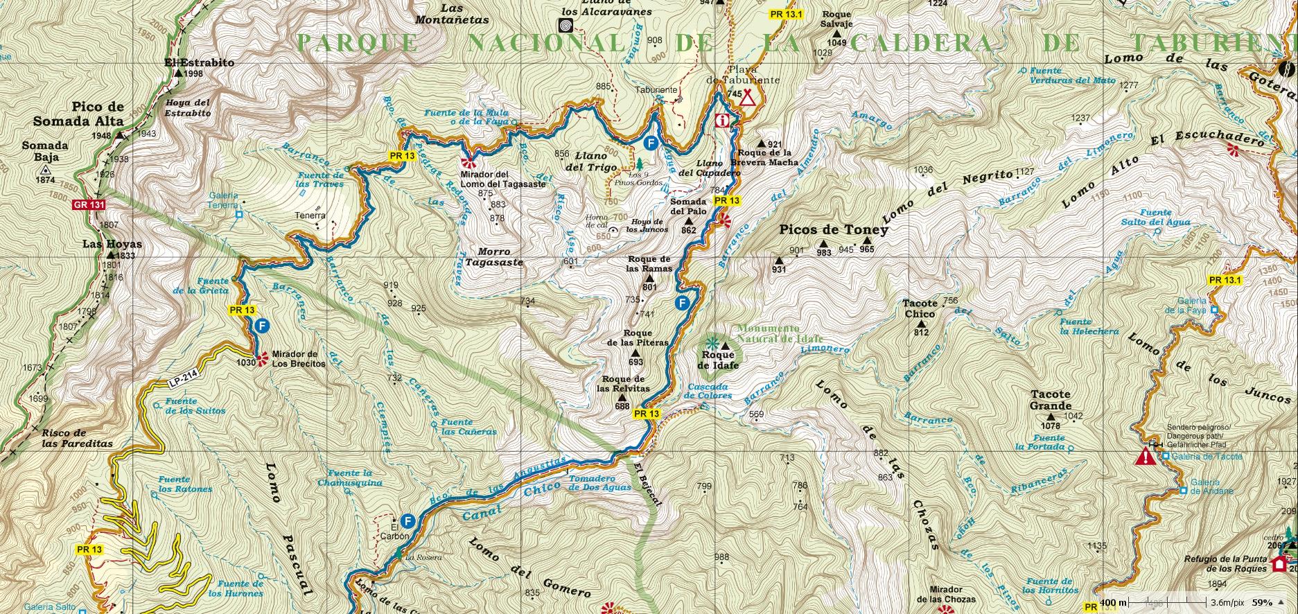
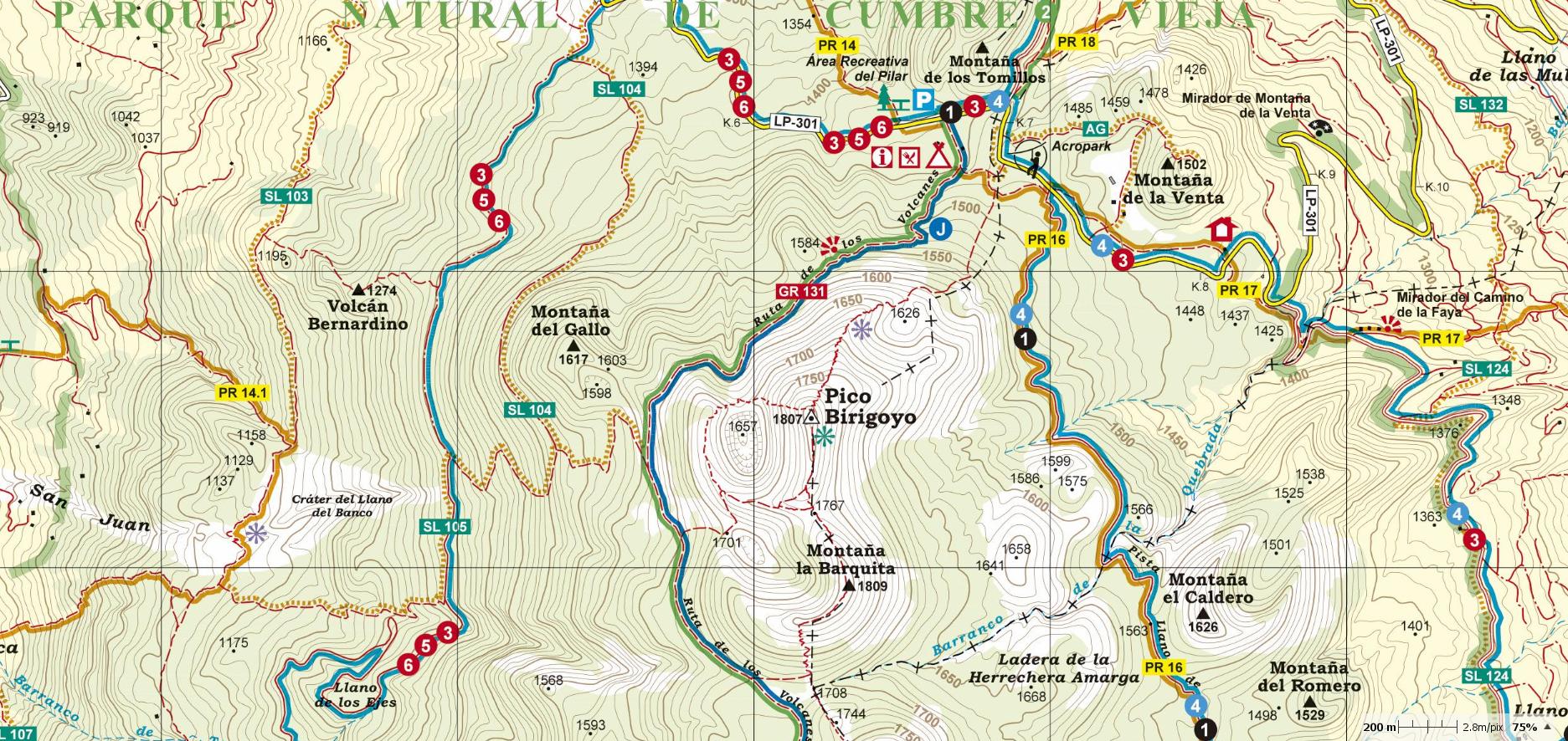
At the beginning of 2017, the publishing house Alpina (widely known in mainland Spain and in the Balearic Islands for its accurate and detailed hiking maps) published the first hiking maps, at a scale of 1:25.000 of La Palma (Canary Islands). Inside the map-set, there are two maps: La Palma Norte (North) and La Palma Sur (South). The signposted paths: GR, PR, SL, educational paths and National park routes have been marked as well as important heritage sites such as: Windmills, watermills, water sources, conduits and filtration galleries, old shepherd's huts, salt-water wells and dry docks. Also included are sites of touristic interest such as: Viewpoints, astronomical viewpoints, campsites, information centres, wine cellars, petroglyphs and other attractions. The fourth updated edition is available since march 2023. |
ALPINA HIKING MAPS LA PALMA/ LA GOMERA/ TENERIFE/GRAN CANARIA |
|---|
|
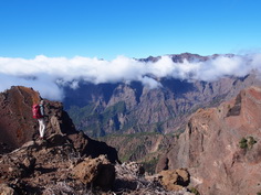
►The most beautiful hikes in La Palma >> ►Update your Alpina hiking map >> ►Around the paths- interesting information WORTH KNOWING >> ►Bildgalerie: Mountain landscapes of the island >>
|
|---|
|
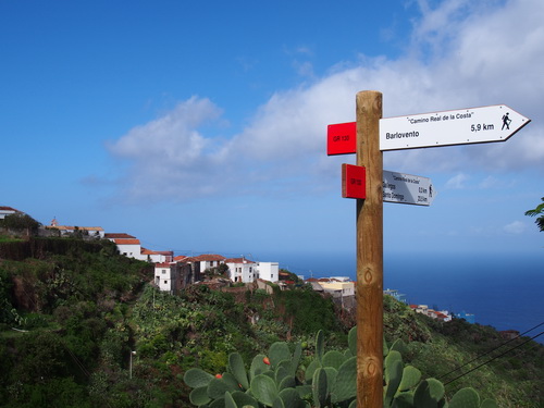
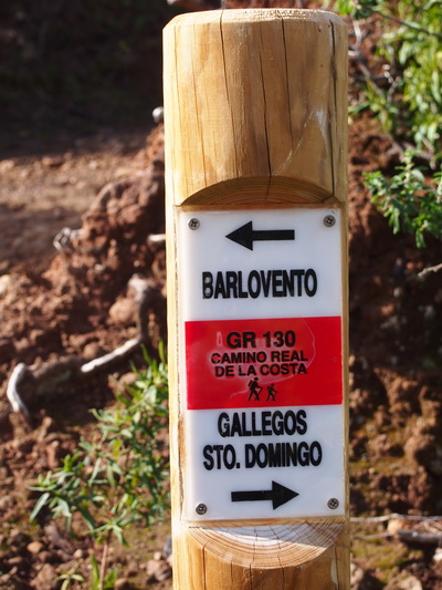
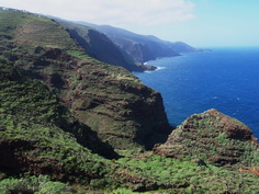
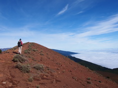
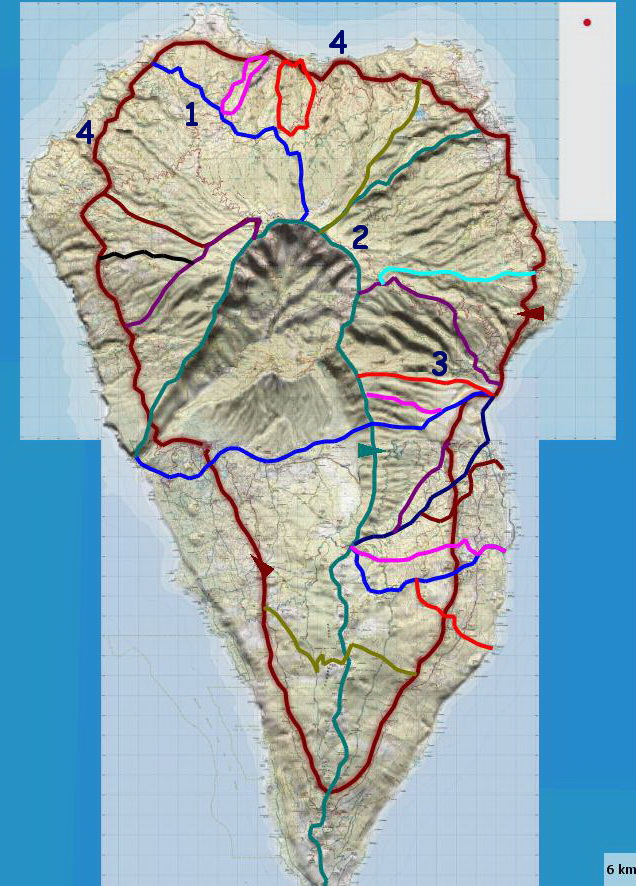
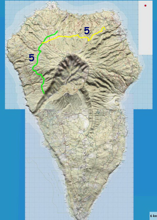
HIKING PATHS IN LA PALMA - Up until 1950, people crossing the island used the following routes: * Some climbed the mountain slopes to the summit ridge (1- "radiales" or radial routes - PR), walked along the crest (2- "Camino de la Cumbre"- GR 131) then walked down a mountain slope (3) to their destination. * Others walked around the coast, crossing many deep and rugged gorges (4- "Camino Real de la Costa"- GR 130) * In the north and north-west, some paths crossed the gorges at a higher level where they weren't very deep (5- "Traviesas" or traverse routes - PR 10 and 20) |
 |
 |
- Around 1995, the island government (Cabildo de La Palma) started opening, signposting and clearing 1000 km of the old path network to create: * GR 130 (Long-distance trail): The coastal path with a length of 159 km. * GR 131: The ridge path (87 km). * PR: The short-distance footpaths (Senderos de Pequeño Recorrido), with a length of more than 10 km climbing and crossing mountain slopes. * SL: The local footpaths, less than 10 km, linking PR and GR paths. |