|
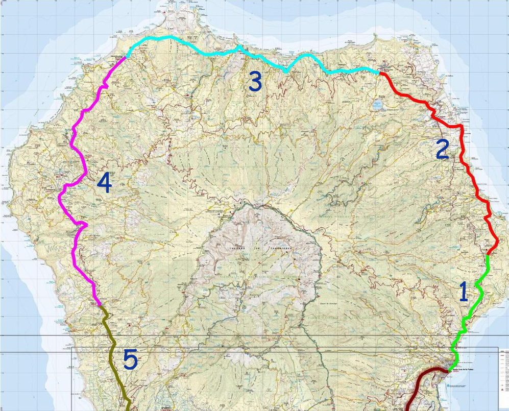
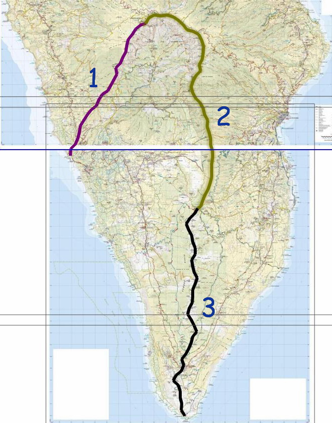
HIKING PATHS IN LA PALMA - Up until 1950, people crossing the island used the following routes: * Some climbed the mountain slopes to the summit ridge (1- "radiales" or radial routes - PR), walked along the crest (2- "Camino de la Cumbre"- GR 131) then walked down a mountain slope (3) to their destination. * Others walked around the coast, crossing many deep and rugged gorges (4- "Camino Real de la Costa"- GR 130) * In the north and north-west, some paths crossed the gorges at a higher level where they weren't very deep (5- "Traviesas" or traverse routes - PR 10 and 20) |
 |
|---|
|
- Around 1995, the island government (Cabildo de La Palma) started opening, signposting and clearing 1000 km of the old path network to create: * GR 130 (Long-distance trail): The coastal path with a length of 145 km. * GR 131: The summith path (67 km). * PR: The short-distance footpaths (Senderos de Pequeño Recorrido), with a length of more than 10 km climbing and crossing mountain slopes. * SL: The local footpaths, less than 10 km, linking PR and GR paths. |
|---|
THE MOST IMPORTANT HIKING PATHS |
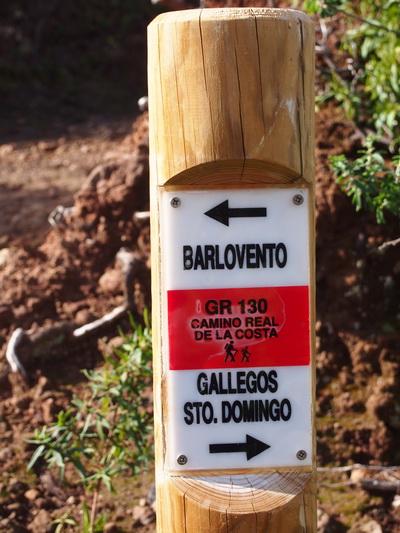
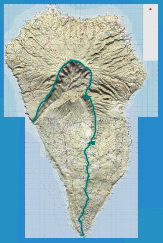
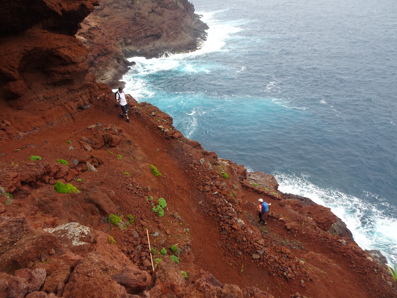
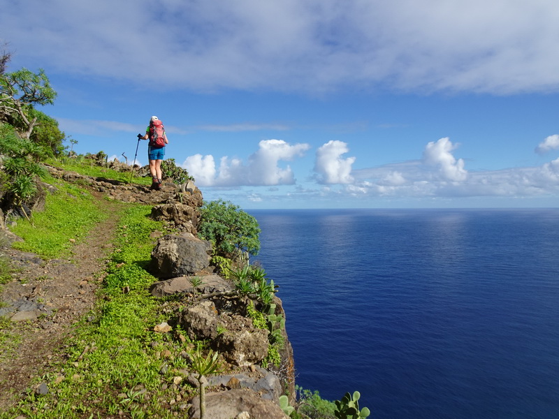
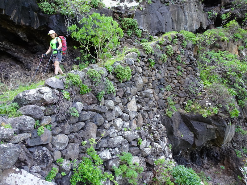
CAMINO REAL DE LA COSTA- GR 130 (COASTAL PATH) |
|---|
CAMINOS RADIALES (RADIAL FOOTPATHS) |
EL CAMINO DE LA CUMBRE- GR 131 (THE SUMMIT- RIDGE PATH) |
|---|
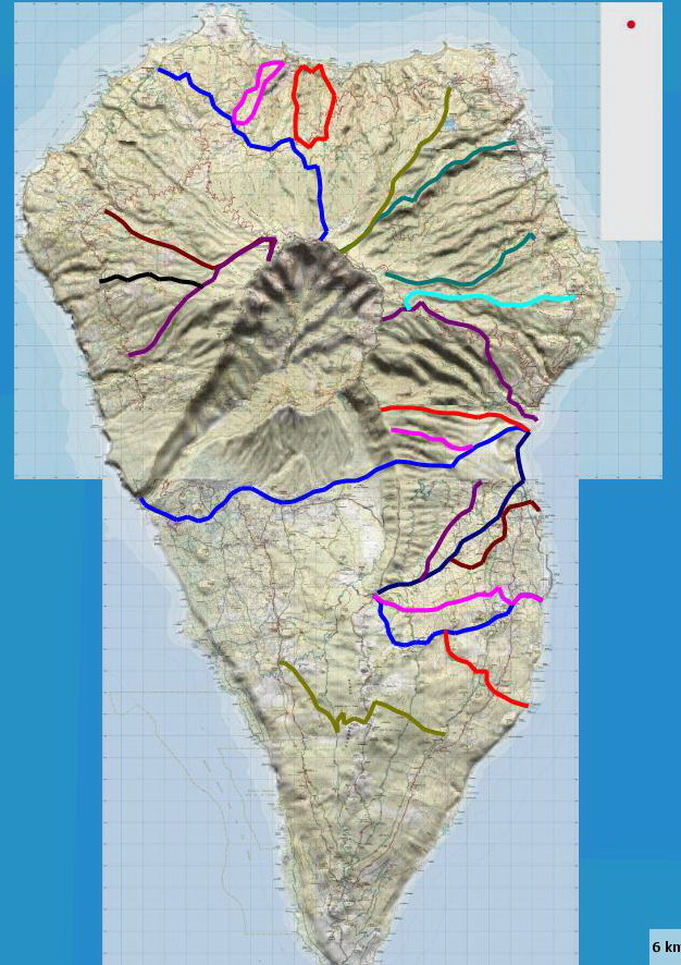
CAMINOS RADIALES +CAMINO DE LA CUMBRE (RADIAL PATHS + SUMMIT PATH) |
FROM GARAFIA TO SANTA CRUZ (PR 9 + GR 131 + PR 2) |
|---|
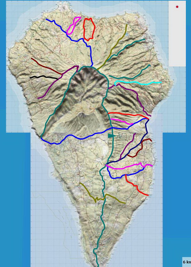
TRAVIESAS- PR 10 AND 20 (TRAVERSE ROUTES) |
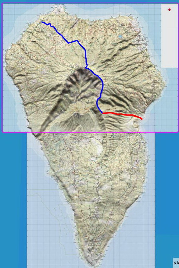
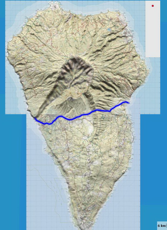
THE MOST IMPORTANT FOOTPATH- PR 1, FROM PUERTO DE TAZACORTE TO SANTA CRUZ |
|---|

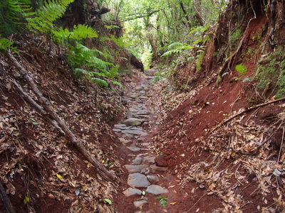
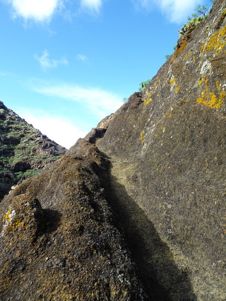
Many paths were already built by the aboriginal people of the Canary Islands and widened by the castilian conquerors after the 15 th. century. There are different kinds of paths: Camino Real, the main path linking the villages, Traviesa (traverse paths), Camino de tira (used for the transportation of wood in oxtracks, Vereda (narrow path), Caminos de herradura (Chart tracks used by horses and donkeys), Camino de trillo (inside a private property), Atajo (shortcut), Camino vecinal (inside a municipality), Camino de prois o puertos (linking the village with its ports or docks and Pasada (just for shepherds in steep slopes) |
With our reconnaissance work through the island, we have improved the tracks of the website "www.senderosdela palma.es". We had realised that many of them had been partially changed. There aren't also any tracks of SL on this website and some PR are missing.
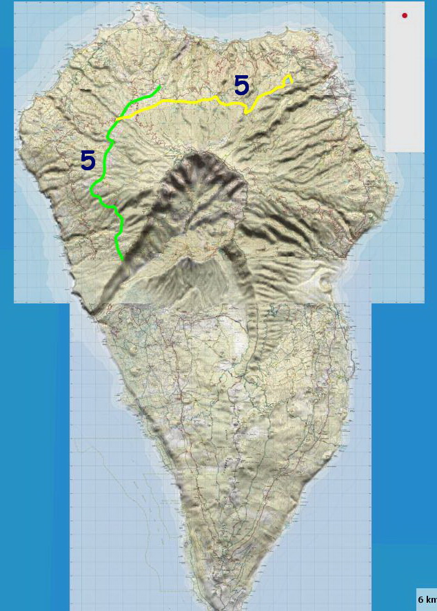
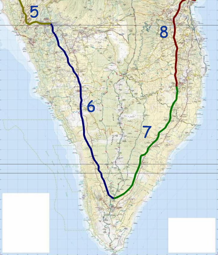
- Long distance path GR 130 >> - Long distance path GR 131 >> - Short routes SL in the north >> |
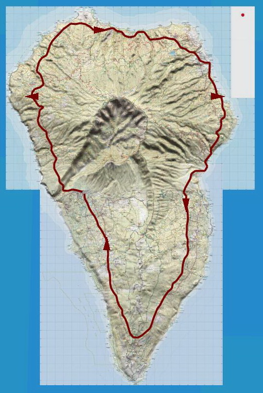
* Track GR 130 >> Please, click here or on the map
* Track GR 131 >>. Please, click here or on the map
|
|---|
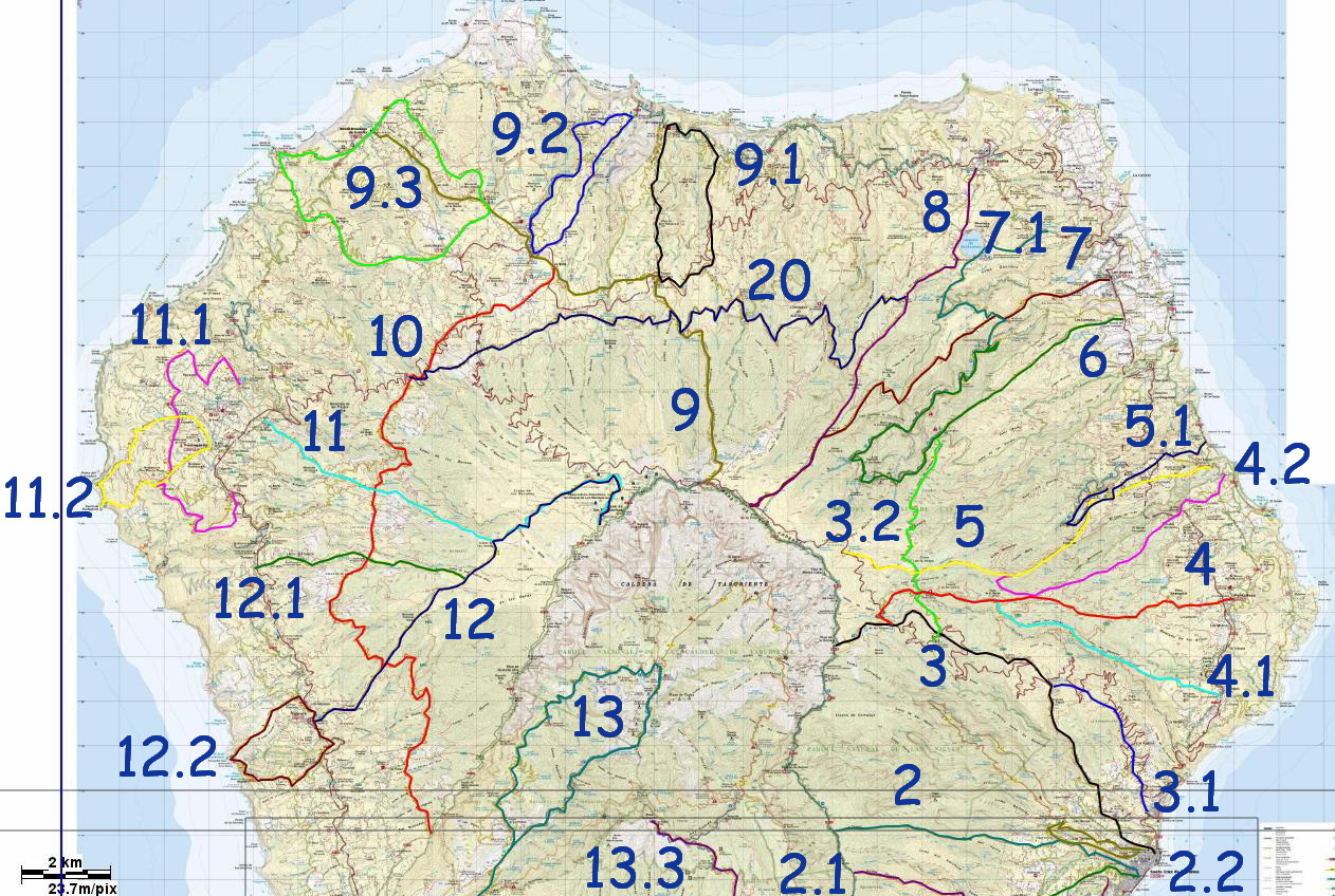
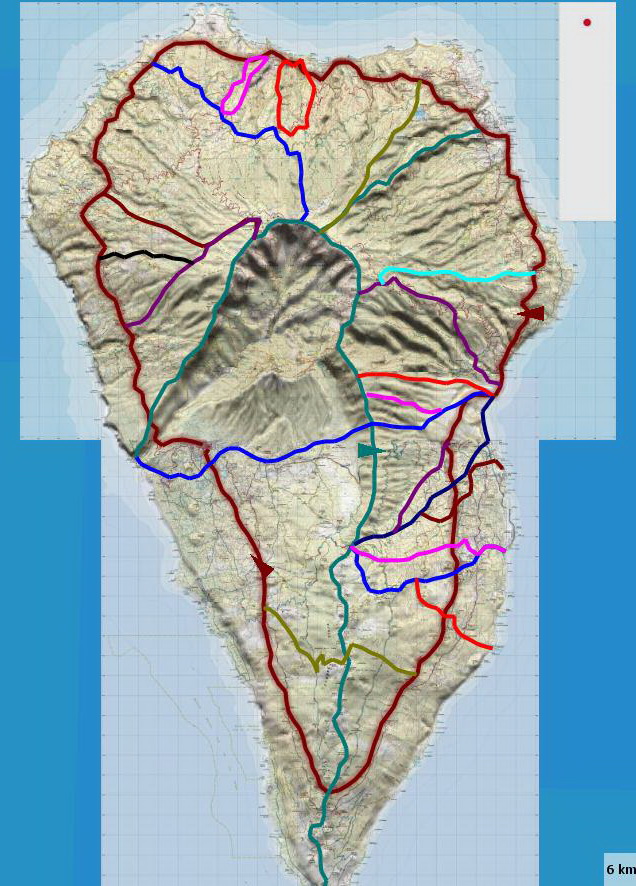
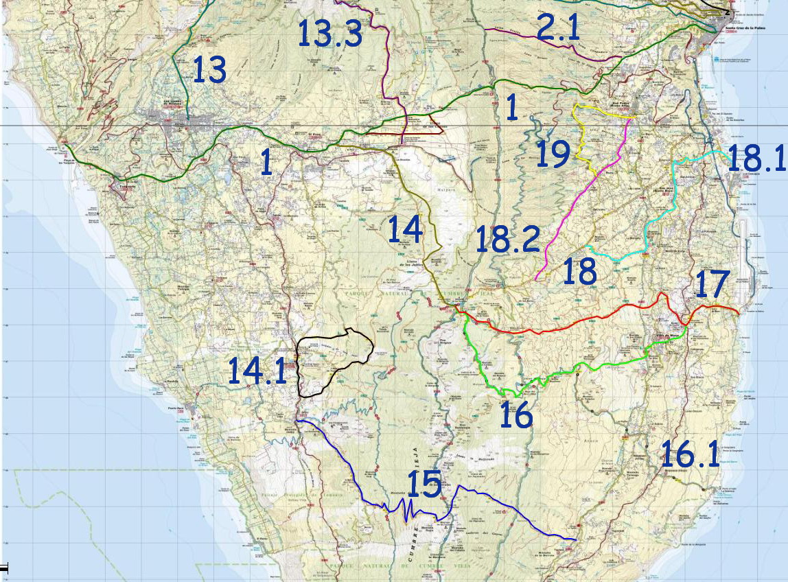
| Please, click in the number of the route on the map or on the following list. |
| Please, click in the number of the route on the map or on the following list. |
* PR LP 1: Santa Cruz- Puerto de Tazacorte >> It was the most important Camino Real linking the biggest villages and the busiest ports * PR LP 1.1: Variante en El Paso >> * PR LP 2.1: Santa Cruz- Lomo del Corchete- Pico de las Ovejas >> Very steep path * PR LP 13: CIRCULAR HIKE Caldera de Taburiente (from Los Llanos de Aridane ) >> * PR LP 13: CIRCULAR HIKE Caldera de Taburiente (from the car park in Barranco de las Angustias) >> One of the most beautiful hikes on the island * PR LP 13.1: La Cumbrecita- Caldera de Taburiente: CLOSED * PR LP 13.3: Pico Bejenado- Centro Visitantes >> * Pico Bejenado from La Cumbrecita >> One of the most beautiful hikes on the island * PR LP 14: Refugio de El Pilar- El Paso >> * PR LP 14.1: CIRCULAR HIKE San Nicolás: Coladas de San Juan >> * PR LP 15: Tigalate- Jedey >> * PR LP 16: Refugio de El Pilar- Playa del Hoyo >> * PR LP 16.1: Roque Niquiomo- La Salemera >> * PR LP 17: Refugio de El Pilar- Villa de Mazo- Playa del Hoyo >> * PR LP 18: Refugio de El Pilar- Santa Cruz >> * PR LP 18.1: Los Cancajos- Cruz de la Pavona (PR LP 18) >> * PR LP 18.2: San Pedro (Breña Alta)- Pista del Carbonero (PR LP 18) >> * PR LP 19: CIRCULAR HIKE- Fuentes de Las Breñas >>
|
|
|---|---|
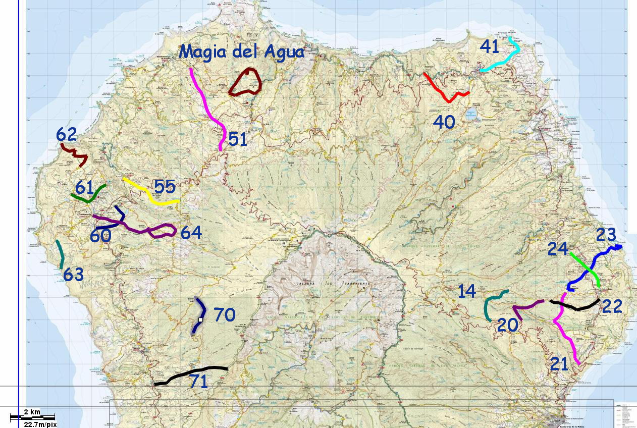
| Please, click in the number of the route on the map or on the following list. |
* CIRCULAR HIKE Magia del Agua (San Antonio del Monte - Garafía) >> * SL LP 51: Garafía >>SL LP 51: Near Santo Domingo de Garafía. It links Hoya Grande with the PR LP 9 near El Jaral |
|
|---|---|
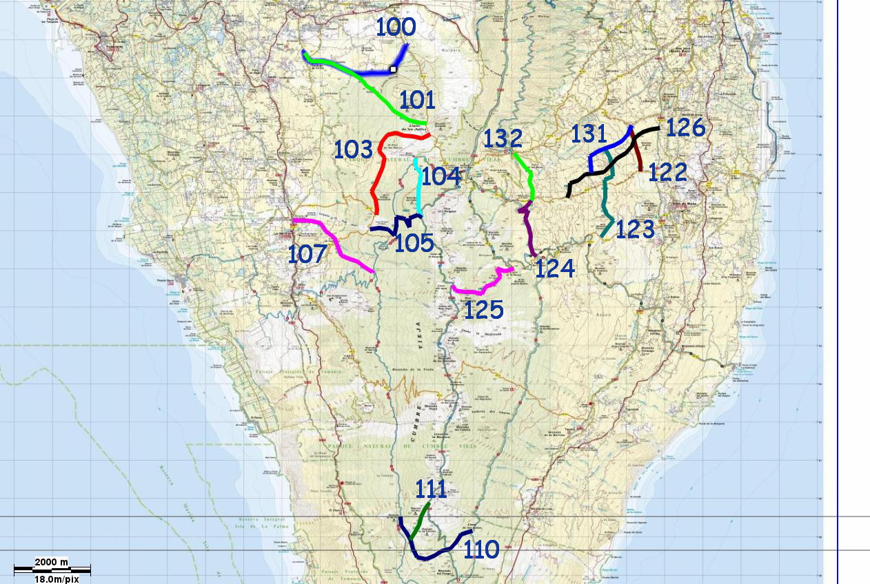
| Please, click in the number of the route on the map or on the following list. |
* SL LP 100: El Paso >>* SL LP 100: In the municipality of El Paso. It links Tacande with the PR LP 14 (pista de Piedras Blancas) * SL LP 101: El Paso >>* SL LP 101: In the municipality of El Paso. It links Tacande with the PR LP 14 (Llano de los Jables) * SL LP 103: El Paso >>* SL LP 103: In the municipality of El Paso. It links Llano de los Jables with the PR LP 14 (Lavas de San Juan) * SL LP 104: El Paso >>* SL LP 104: In the municipality of El Paso. It links the viewpoint Mirador del Llano del Jable with the GR 131 (pista de La Barquita) * SL LP 105: El Paso >>* SL LP 105: In the municipality of El Paso. It links the PR LP 14.1 (Lavas de San Juan) with the GR 131 (pista de La Barquita) * SL LP 107: El Paso >>* SL LP 107: In the municipality of El Paso. It links San Nicolás with the pothole Hoyo de la Sima * SL LP 110: Los Canarios (Fuencaliente) >> * SL LP 111: Los Canarios (Fuencaliente) >> * SL LP 122: Villa de Mazo >>* SL LP 122: Between Breña Baja and Villa de Mazo. It links the PR LP 18.1 and the 17 * SL LP 123: Villa de Mazo >>* SL LP 123: Between Breña Baja and Villa de Mazo. It links the PR LP 16 and the SL LP 131 * SL LP 124: Villa de Mazo >>* SL LP 124: Between Breña Baja and Villa de Mazo. It links the PR LP 16 and 17 * SL LP 126: Villa de Mazo >>* SL LP 126: Between Breña Baja and Villa de Mazo. It links the PR LP 17 with the GR 131 (Cruz del Monte) * SL LP 131: Breña Alta >>* SL LP 131: Between Breña Baja and Villa de Mazo. It links the PR LP 18.1 with the SL LP 126 * SL LP 132: Breña Alta >>* SL LP 132: Between Breña Baja and Villa de Mazo. It links the PR LP 17 and 18 |
|
|---|---|